
Walk a Calumet City Street
Begin with the address exactly as it appears on a letter, tax notice, photo, directory page, or family paper. Keep unit and direction details. The aim is to turn that text into a Cook County parcel identification number, or PIN. The PIN remains useful when a street label, postal form, or house number is unclear. It also links map, assessment, tax, and recording systems without assuming that a person named in one source still occupies the site.
- Check the address and ZIP through the postal route, then enter the street in CookViewer.
- Select the parcel, record its 14-digit PIN, and compare nearby lots.
- Open the Assessor record and compare location, class, neighborhood, and tax district.
- Carry the PIN into the recording index and follow grantor and grantee names through deeds.
- For an older household, search the number under West Hammond and Calumet City in dated sources.
This sequence makes a street directory search easy to check. It keeps ownership, occupancy, mailing, and map evidence in the right roles. Illinois voter tools can confirm one registration when the required identity fields are known, but the public form does not offer a street-wide list.
Calumet City Address Layers
A property may have a postal address, GIS point, Assessor display address, legal description, and directory spelling. The Assessor warns that its displayed location may be neither the legal nor postal address. CookViewer may return several nearby properties, at times within about 100 feet. Preserve each source label.
- Parcel
- A mapped unit of land identified by a PIN.
- Situs address
- A location used on a map or assessment record, which can differ from mail.
- Plat
- A recorded map dividing land into blocks, lots, streets, or easements.
- Criss-cross directory
- A book arranged by street and house number rather than surname.
The county Address Points layer preserves apartment, building, floor, suite, unit, wing, corridor, and lot types. Dropping a unit can merge distinct places. Confirm mail through USPS ZIP Lookup.
Map Calumet City Street Parcels
CookViewer is the visual bridge between a street and parcel. It accepts an address, intersection, or PIN and can select several parcels. The current tool offers nearby search, historic parcel layers, exports, and printed reports.
| Control | Input | Street use |
|---|---|---|
| Parcel PIN | 10 or 14 digits, dashed or plain | Return to a known lot |
| Parcel Address | Property address | Match number to lot |
| Address Locator | Address or intersection | Orient cross streets |
| Nearby search | Parcel and radius | Inspect nearby lots |
| Historic archive | Dated layer | Check boundary change |
Save the PIN, displayed address, selected parcel, and date. A map match is spatial evidence, not title or current-residence proof.
Search Calumet City Streets Precisely
The Cook County Assessor search asks for house number and street name. Do not add Ave, St, or Pl. Direction, unit, and city refine the result, and CAPTCHA is required. Advanced search supports ranges, partial PIN, township, property class, and appeal fields.
| Field | Need | Note |
|---|---|---|
| House Number | Yes | Use address number |
| Direction | Optional | Keep when present |
| Unit | Optional | Keep subaddress |
| Street Name | Yes in practice | Omit street suffix |
| City | Optional | Use Calumet City |
| PIN | Optional | Use 14 digits |
A parcel card can show PIN, township, class, neighborhood, tax code, values, exemptions, appeals, and reassessment data. Owner and mailing fields were not confirmed, so this Calumet City street directory does not promise them.
Calumet City Records by Street
No record is a full household roll. These sources form the address chain.
| Source | Keeper | Shows | Access |
|---|---|---|---|
| Parcel card | County Assessor | PIN, class, values, appeals | Web search |
| Parcel map | County GIS | Geometry, ZIP layer, nearby lots | CookViewer |
| Instruments | County Clerk | Deeds, liens, plats, parties | Online and counter |
| Property tax | County Treasurer | Tax status and account fields | Public search |
| Permit file | City Building & Zoning | Held permits, code, zoning | Office or FOIA |
| Old entry | Libraries | Dated name, phone, address | Scan or reading room |
The Treasurer search adds the tax layer. Tax Year 2023 and earlier county records route to the Clerk. A taxpayer field is not an occupant list.
Follow Calumet City Deeds
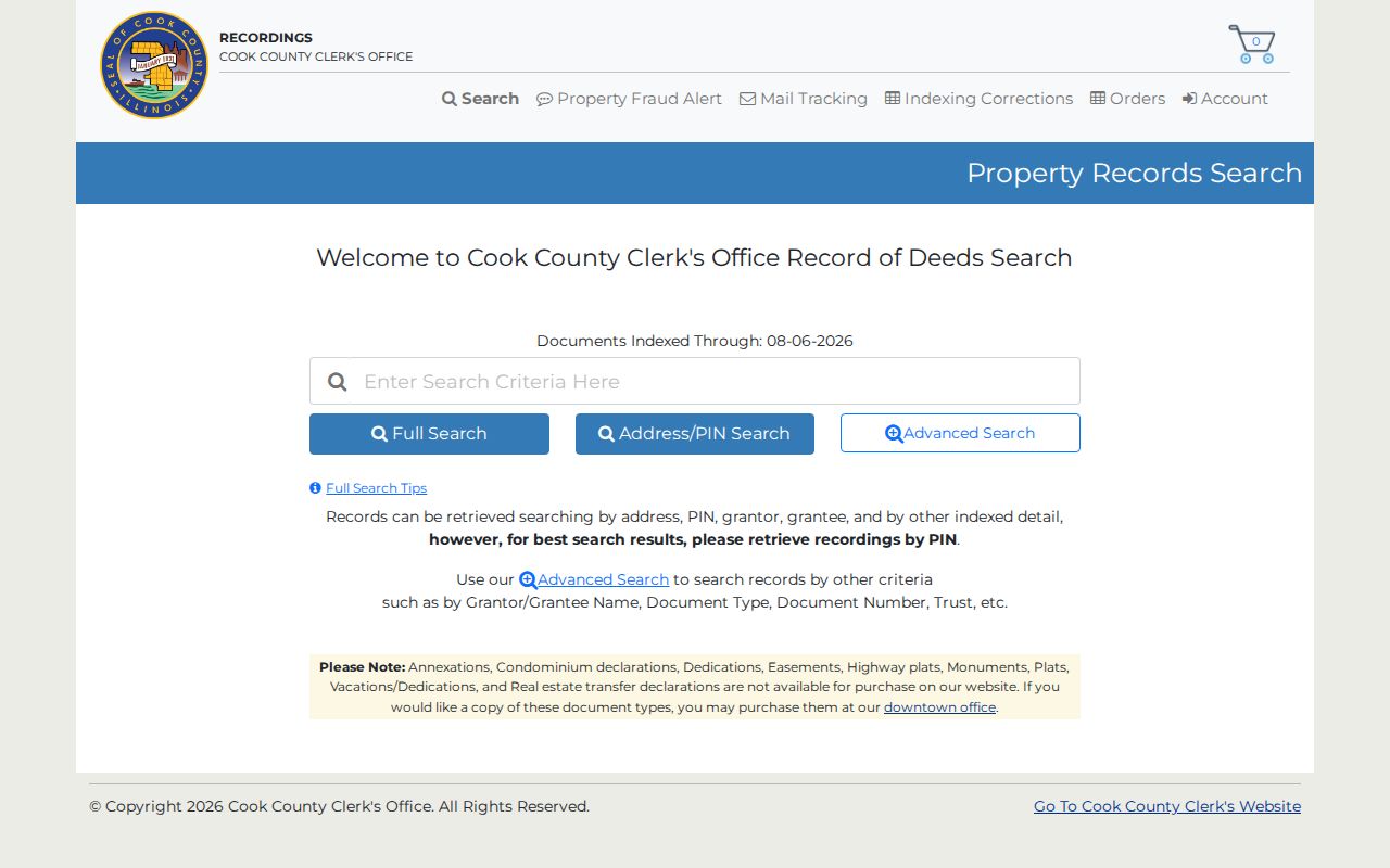
The Cook County recording search says PIN is the best key. Official context describes online coverage from 1985 forward, and the researched live portal displayed indexing through August 6, 2026. Older deeds may need tract books, staff help, or the Chicago counter.
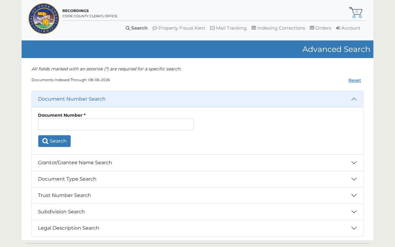
A grantor gives a property interest; a grantee receives it. Note document number, date, type, names, legal description, and related instruments. The advanced form adds party, date, subdivision, lot, and document-type controls.
The source screen shows the official entry route and PIN guidance.
The advanced screen supplies deeper legal and party controls.
Check Calumet City Tax Records
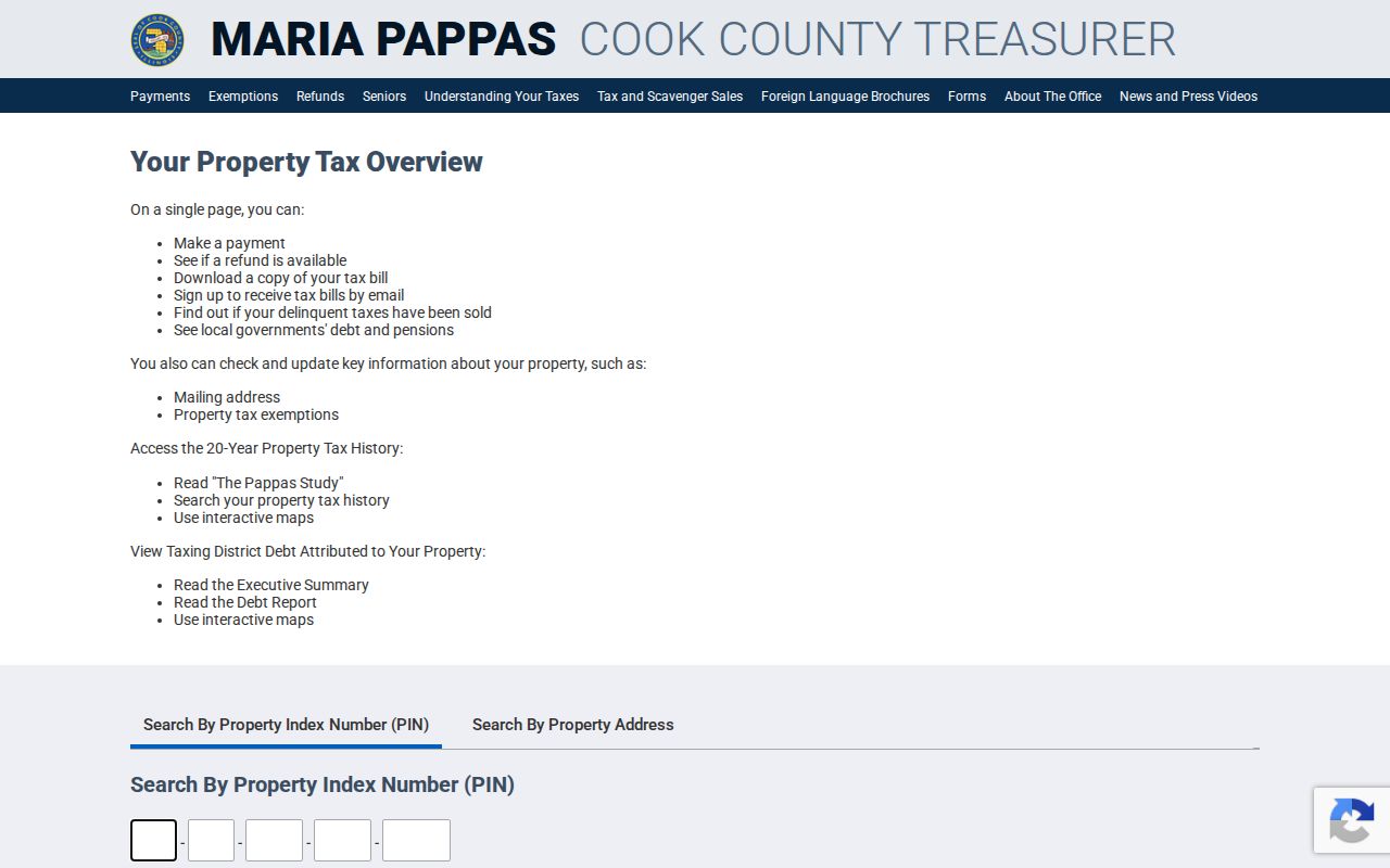
The county tax screen gives a second parcel-keyed check after the Assessor. Use it to compare PIN, property and mailing fields, class, returned-bill details, tax-sale status, and the relevant tax year. Do not turn the taxpayer name into a claim about a full household.
The captured Cook County Treasurer search shows the official parameter screen.
Request Calumet City Property Files
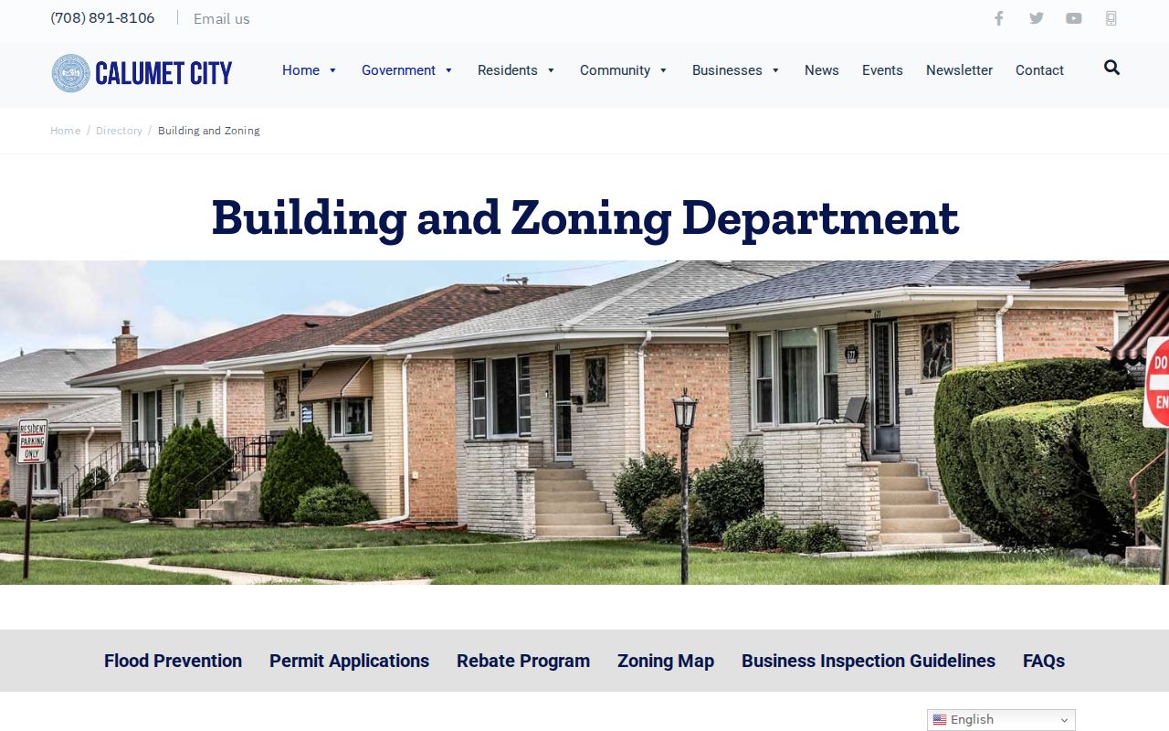
No public city permit index was found. Building & Zoning handles building, inspection, zoning, floodplain, code, contractor, and property-process files at 670 Wentworth. Give the address, PIN, record type, and date span. Phone contact is 708-891-8120.
Use the department page, then city FOIA if no direct route applies. The captured office page confirms the proper municipal handoff.
Search West Hammond Streets
Calumet City began as West Hammond in 1893 and took its current name in 1923. A pre-1923 address may sit under West Hammond. Later books may use Calumet City/Burnham, Calumet/Burnham, or Hammond titles that include the city.
No official old-to-new number crosswalk was found. When a number fails, compare legal description, PIN, plats, deeds, Sanborn maps, news, and directories. The Calumet City city directory page lists the historical runs and reading-room routes.
Note: Search both municipal names, but join two records only when a second field agrees.
Limits of Calumet City Street Records
A property file can connect a name with a recorded interest, tax account, business site, or dated directory entry. It cannot list every adult, child, guest, or other person at home. Voter lookup checks one registration with required identity fields, not a street-wide roll. Driver and utility customer details are not public household lists.
Books have gaps, maps may point near the wrong parcel, and mailing addresses can lead away from the site. Mark the year and purpose of each source, and verify any current claim with its custodian.
Use address records lawfully. Calumet City street information supports legitimate personal, family, property, and civic research. Never stalk, harass, intimidate, or harm anyone.
Build a Calumet City Address Packet
Keep the evidence together as the street search moves among offices. Start with the exact address supplied and the date received. Add the USPS result, county address point, CookViewer parcel view, PIN, Assessor card, and tax result. Record the form of the address each system displayed. For recordings, list document number, date, type, grantor, grantee, and legal description. A screen without its source URL and access date can be hard to interpret later.
Historical evidence needs the same care. Note the directory title, publisher, year, reel or shelf code, page, municipality label, and exact printed line. Save the abbreviation key. For news, record title, issue date, page, and repository. For a permit request, keep its date, address, PIN, scope, response, and any stated retention limit. This packet shows which facts agree and which remain open.
Do not smooth over conflicts. A ZIP mismatch, changed number, alternate direction, or nearby parcel can prevent a false match. Mark an inference until a plat, legal description, or custodian response supports it. The strongest street directory result keeps the raw forms beside the final conclusion.
Finish with a short finding log. State whether the address matched USPS, whether CookViewer returned one parcel or several, and which PIN was selected. List every recording search tried, even when it returned no result. Note whether city staff, the library, or an archive still needs to answer a request. A negative portal search does not prove that no record exists, since older deeds, permit files, and directory volumes may be available only at a counter or reading room. Dates matter too. The Assessor card, tax screen, recording index, directory edition, and map layer describe different moments. Keeping those dates beside each claim prevents a past household or former owner from being presented as current.
Calumet City Unit Addresses
For a multi-unit building, record a unit only when the source displays it. A county parcel may cover the whole structure while a permit or directory uses an apartment number. Do not assign the parcel owner to every unit. If a street crosses the city boundary, confirm the municipality and ZIP at the exact house number. Nearby Hammond, Burnham, and Chicago records can share street names without sharing a custodian. A sound address packet keeps those jurisdiction lines clear and states whether each source identifies an owner, taxpayer, applicant, voter, or occupant.
Compare the same dated role across systems. A taxpayer name from one year should not be presented as the current occupant, and a permit applicant may be a contractor or agent. Save the access date and the record's own effective year beside every result.