
Verified Calumet City ZIP Coverage
Official material reviewed for the Calumet City ZIP code directory verifies 60409 as the city-named postal route. Current municipal, library, property, and USPS examples use Calumet City, Illinois 60409. The evidence does not prove that every point inside the city line has the same delivery code, or that every 60409 address lies within the municipality. An address-level USPS result remains the final postal check.
| ZIP Code | Areas Covered | Post Office | Notes |
|---|---|---|---|
| 60409 | Calumet City-named municipal, library, and property examples | Calumet City Post Office, 1200 Ring Road | Verified route; edge streets still need an address lookup |
| Additional code | No additional Calumet City code verified in reviewed official material | None confirmed | Do not add a nearby ZIP without USPS or Cook GIS evidence |
The post office address proves a Calumet City postal route, not a polygon. No PO-box-only code, unique institutional code, or second city-serving code was confirmed. That negative finding matters: unofficial ZIP maps should not be used to fill the table. Where the street is near a boundary, search the full address with direction and unit.
Verify Calumet City Postal Addresses
The USPS ZIP Code Lookup is the main address-to-ZIP authority. Enter the complete street address, unit when present, city, and state. Preserve the standardized address and returned postal city exactly. The unattended research session could not complete the anti-automation form, so no unverified edge-street list was invented.
The USPS Postmaster Finder supplies office history and an official recycling list identifies the Calumet City post office at 1200 Ring Road. Office evidence is useful for routing questions, but it does not establish the delivery boundary. For a disputed result, ask USPS about postal delivery and Cook County GIS about map geometry.
Note: Keep the USPS result with its access date because an old directory ZIP does not establish the current code for an address.
Map Calumet City ZIP Geometry
The Cook County address and ZIP MapServer provides the spatial check behind this Calumet City ZIP code directory. Layer 0 holds address points with complete address number, street name, subaddress fields, and place name. Layer 1 holds ZIP boundaries with a field named ZIP. Plot the address point, identify the boundary containing it, and then validate the postal result with USPS.
| GIS layer or field | What it contributes | Limit |
|---|---|---|
| Address Points | Complete number, street, unit, place | Map record, not final postal authority |
| ZIP Code Boundaries | Polygon and ZIP field | Must be checked against exact address |
| Place Name | Mapped place label | May differ from mailing city |
The captured county service page documents the layer names and fields used for the ZIP check.
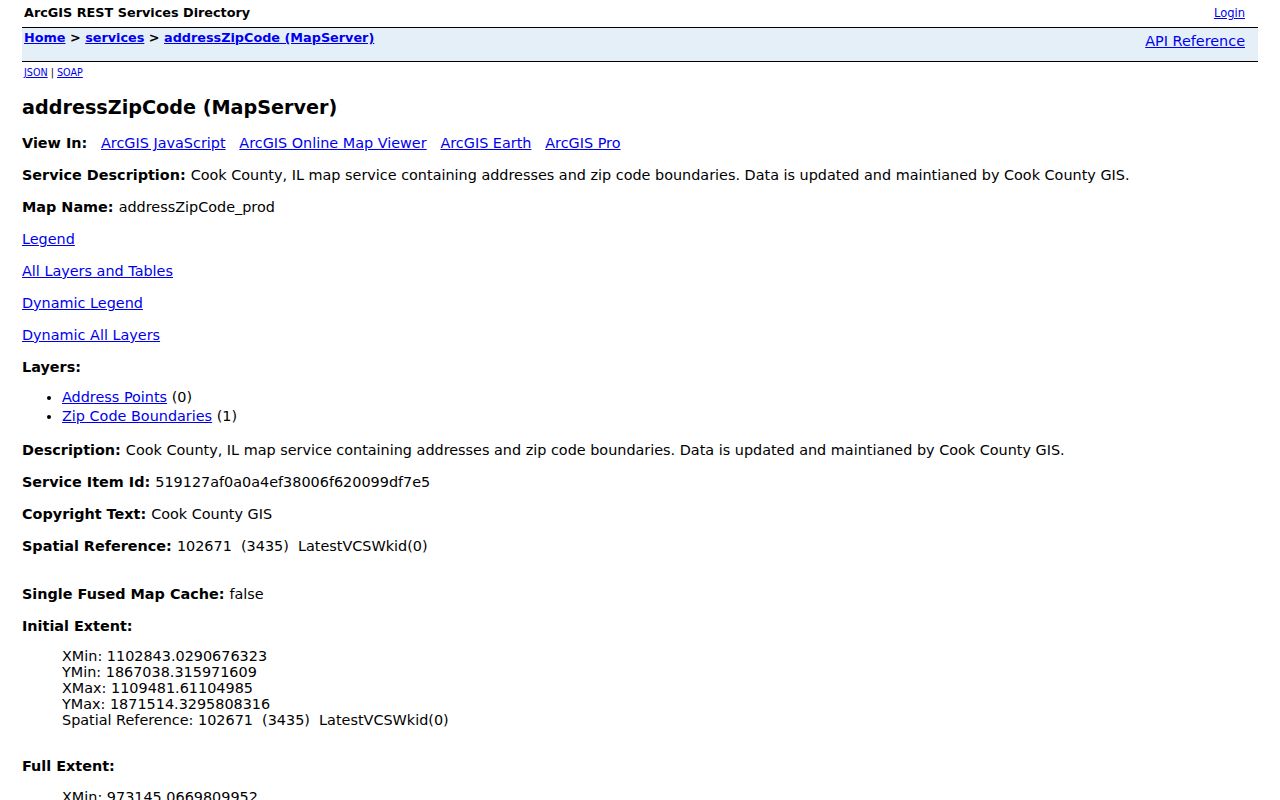
The image is a source screen, not a completed household query. Pair a selected address point with the polygon and USPS result before assigning a code.
Find Calumet City Residents by ZIP
Not every official portal accepts a ZIP. The voter registration form and I-CASH can use one, while the Cook Assessor form inspected in research uses City rather than ZIP. The recording portal uses an address, PIN, name, or legal description. Work from postal verification to the record system rather than assuming one broad ZIP query will return local residents.
- Verify the full Calumet City mailing address through USPS and retain the standardized result.
- Compare the Cook GIS address point with the ZIP boundary field to investigate an edge or mismatch.
- Use the ZIP in an authorized individual voter lookup or as an optional I-CASH filter when the other required facts are known.
- Convert the address to a PIN for assessor or recording work, because those systems do not offer the same ZIP filter.
Once 60409 narrows the area, use the Calumet City street directory for address and parcel steps. A ZIP is too broad to prove that two similar names refer to one person.
Calumet City ZIP Search Fields
The Illinois voter Registration Lookup requires First Name, Last Name, Birth Date, and Five Digit Zipcode. After the ZIP is supplied, conditional Street Number and Street Name fields may appear. It confirms an individual registration and is not an open ZIP-wide resident roll.
| System | ZIP control | Proper use |
|---|---|---|
| Illinois voter lookup | Required five-digit ZIP | Individual registration match |
| I-CASH | Optional city and ZIP after name | Narrow an unclaimed-property search |
| Cook Assessor | No ZIP field confirmed | Use address, city, or PIN |
| Cook recording portal | No ZIP control | Use PIN, address, party, or legal description |
Forms use ZIP fields for different reasons. The city's block-club and business-license forms collect a postal code, but neither is a browseable resident directory. I-CASH property data may also reflect an older address, not current residence.
Calumet City ZIP Search Scale
Census QuickFacts estimates Calumet City's 2025 population at 34,798, compared with 36,033 in 2020 and 37,042 in 2010. Those figures show why a single ZIP is a broad first cut, not the end of a person search. They are city population measures and cannot be converted into the number of people inside a postal polygon.
The 2024 CMAP Calumet City Subarea Plan adds another geography. Its study area is bounded by Memorial Drive, State Line Road, 156th Place, and Burnham Avenue, covers Wards 1 and 5, and names the Pulaski, Burnham, and Wentworth corridors. Planning areas, wards, postal codes, and municipal borders may overlap without being equal.
Save Calumet City ZIP Evidence
Postal and map systems change on different schedules. Keep a short evidence packet for an edge address: the USPS standardized result, the Cook GIS address point, the ZIP polygon value, the parcel or assessor display, and the date each source was checked. Label each item by what it proves. USPS supports mail delivery, GIS supports spatial placement, and the city or Census map supports municipal jurisdiction.
Older records need another line in the notes. A directory may show a former ZIP, an abbreviated city, a route, or no postal code at all. A property record may show a situs address, which is the parcel location, while its tax mailing address points elsewhere. A voter match uses registration data, and I-CASH may retain a past address tied to abandoned property. These records should not overwrite one another.
If the sources disagree, do not pick the most convenient result. Ask USPS about delivery, Cook County GIS about an address point or polygon, and Calumet City Clerk or Building and Zoning about the municipal address record. Illinois FOIA can request a defined city record when no public index exists, but the request itself is public. State the street, unit, date range, preferred format, and the precise record sought without adding sensitive personal details.
Calumet City ZIP and City Limits
The Census incorporated-place map shows Calumet City, Cook County, Indiana, and nearby municipal geography, but it does not assign ZIP codes. Four mismatch types require care: a city line crossing a postal boundary, a postal city name differing from the municipality, an assessor display address differing from postal or legal form, and a missing apartment or subaddress.
For a disputed address, run USPS with the direction and unit, inspect the Cook GIS point and boundary, compare the parcel in CookViewer, and preserve the postal city separately from the municipal name. The Calumet City ZIP code directory does not claim an official street-by-street boundary table because none was located.
- ZIP and ZIP+4
- A ZIP identifies a delivery area. The extra four digits narrow delivery to a smaller segment.
- PO-box ZIP
- A code assigned mainly to post-office boxes rather than normal street delivery.
- Unique ZIP
- A code assigned to one high-volume organization. None was verified for Calumet City.
- Carrier route
- A mail-delivery path within a ZIP. It is not the same as a city ward or parcel block.
Boundary check. A Calumet City mailing label does not alone prove city jurisdiction. Confirm postal, parcel, and municipal facts in their own official systems.